
Related

Sychevsk town map. Russian Empire - Public domain map
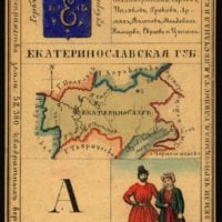
Provinz Ekaterinoslav, Russisches Reich
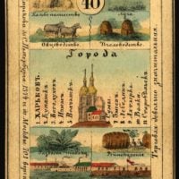
Woiwodschaft Charkow Diese Karte ist eine von 82 illustrierten Souvenirkarten - eine für jede Provinz des Russischen Reiches, wie sie 1856 existierte.
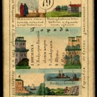
Provinz Schemacha Diese Karte ist eine von 82 illustrierten Souvenirkarten - eine für jede Provinz des Russischen Reiches, wie sie 1856 existierte.
Provinz Jaroslawl, Russisches Reich
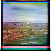
Blick auf die Stadt Kem. Provinz Archangelsk, Russland. Fotos von Prokudin Gorski.

Дед Мороз С-Рождеством - Russian postcard. Public domain image.

Grigori Yefimovich Rasputin, Russian Empire
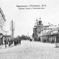
Wladimir - Die Große Moskauer Straße. Rathaus.
Gzhatsk city plan. Russian Empire - Public domain map
Zusammenfassung
План города Гжатск.
Планы городов и карты уездов Смоленской губернии конца XVIII века
Plans of cities and maps of districts of Smolensk province at the end of the XVIII century
Plans of cities and maps of counties of Smolensk province at the end of the XVIII century. Планы городов и карты уездов Смоленской губернии конца XVIII века.
- Gzhatsk city plan. Russian Empire - Public domain map
- Gzhatsk city plan. Russian Empire - Public domain map - PICRYL
- Smolensk province maps - end of XVIII century.
- Smolensk province maps - end of XVIII century. - PICRYL
- Планы городов и карты уездов Смоленской губернии конца XVIII ...
- Атлас Смоленской губернии 1790-х годов - LiveJournal
- Планы городов и карты уездов Смоленской губернии конца XVIII ...
- Гжатский тракт | Внедорог - vnedorog.ru
- Атлас Смоленской губернии
- Гжатский тракт — DRIVE2
Tags
гатск
российская империя
Russisches Reich
Russland
россия
smolensk
смоленск
смоленская губерния
города
Städte
Provinz Smolensk
Karten
карт
gzhatsk
18. Jahrhundert
Geschichte Russlands
hohe Auflösung
Stadtpläne
planen
druckt
Datum
1775 - 1800
in sammlungen
Quelle
Russian State Library
Link
Copyright-info
No known copyright restrictions